Location
|
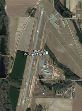
|
Airport Operations
|
|
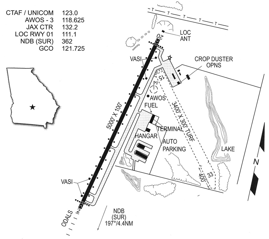
Airport Communications
CTAF/UNICOM |
123.0 |
WX AWOS-3 |
118.625 (229-426-5072) |
WX AWOS-3 at TMA (19 nm SW) |
118.525 (229-387-7291) |
Runway Information 02/20
Dimensions |
5002 x 100 ft. / 1525 x 30 m |
Surface |
asphalt, in good condition |
Weight Bearing Capacity |
Double wheel: 28000 lbs |
Runway Edge Lights |
medium intensity |
Runway |
RUNWAY 02 |
RUNWAY 20 |
Latitude |
31-40.591033N |
31-41.398283N |
Longitude |
083-16.477917W |
083-16.279200W |
Elevation |
356.0 ft. |
364.0 ft. |
Gradient |
1.0 |
1.0 |
Traffic Pattern |
left |
left |
Runway Heading |
015 magnetic, 012 true |
195 magnetic, 192 true |
Markings |
nonprecision, in good condition |
nonprecision, in good condition |
Visual Slope Indicator |
4-box VASI on left |
4-box VASI on left |
Approach Lights |
ODALS: omnidirectional approach lighting system |
|
Instrument Approach |
LOCALIZER |
|
Obstructions |
40 ft. trees, 1800 ft. from runway, 40:1 slope to clear |
12 ft. trees, 440 ft. from runway, 250 ft. right of centerline, 20:1 slope to clear |
Runway Information 15/33
Dimensions |
3400 x 300 ft. / 1036 x 91 m |
Surface |
turf, in good condition |
Runway Edge Markings |
/33 THLDS MKD WITH WHITE TIRES |
Runway |
RUNWAY 15 |
RUNWAY 33 |
Latitude |
31-41.294517N |
31-40.861200N |
Longitude |
083-16.225967W |
083-15.809283W |
Elevation |
365.0 ft. |
332.0 ft. |
Gradient |
0.8 |
0.8 |
Traffic Pattern |
left |
left |
Runway Heading |
144 magnetic, 141 true |
324 magnetic, 321 true |
Obstructions |
50 ft. trees, 1000 ft. from runway, 200 ft. right of centerline, 20:1 slope to clear |
46 ft. trees, 460 ft. from runway, 125 ft. right of centerline, 10:1 slope to clear |
CONTACT THE MUNICIPAL AIRPORT
|


